The Omulunga Palm Route

The Omulunga Palm Route is not only the gateway to Angola but also links the remote and desolate northwest region (the Arid Eden Route) to the lush water ecosystem of the Four Rivers Route (Kavango and Zambezi regions).
This route showcases Namibia’s heartbeat. It is located along the northern border of Namibia and stretches from Ruacana in the west to Nkurenkuru in the east and is named after the distinctive palms that accent the desolate landscape, called Omulunga in Ovambo. The route is the quintessential oasis for weary travellers and serves as a practical stop-over for visitors to refuel and restock in the heart of a bustling African community.
With vibrant colours, sights and sounds, travellers will enjoy lapping up the traditional and contemporary Ovambo culture and steal a glimpse into the local tribal royalty. The area echoes a strong liberation history which, if delved into, will fascinate history buffs, while nature lovers can enjoy the abundant wildlife and wilderness in the world-famous Etosha National Park.
Top 5 reasons to visit
- Explore Namibia's modern history with an array of war museums and shrines commemorating those who struggled during the War on Independence
- Discover a unique culture, traditional villages, royal homesteads, bustling African markets and hear the drums beat in Namibia largest city
- Gain a different perspective on Etosha National Park by entering through the north-eastern gate at King Nehale (within King Nehale Conservancy)
- The Oshakati open market is said to be the biggest in the country and is an important part of the town's economic infrastructure. The open market is a cultural experience in its own right as travellers can buy anything from Mopani worms, traditional beer, local crafts and artefacts, and many other local delicacies
- Visit one of Africa's largest waterfalls outside Ruacana and discover how the Kunene Rivers is harnessed to generate renewable energy for Namibia
Interesting facts
- The Cuvelai-Etosha River Basin is located in the north central regions of Namibia, including Ohangwena, Omusati, Oshana and Oshikoto. The Cuvelai drainage system originates in Angola, however most water travels in shallow ephemeral watercourses known as oshanas
- "Efundja" is the word used for major floods during the rainy season when travellers can find the oshanas covered with water
- In 2012, scientists found over 5-billion cubic meters of water within the Cuvelai-Etosha Delta (Northern Namibia and Angola). The aquifer is said to be more than 200m deep but could supply water for a further 400 years at present consumption levels
- The Oshigambo River (also Ekuma River) links Lake Oponono, Cuvelai Delta with the Etosha Salt Pan. This river is an ephemeral river and rarely carries surface water
- Natural salt pans are flat expanses of ground covered with salt and other minerals. Usually shining white under the sun, these pans are found in deserts. Namibia contains a vast array of salt pans, the largest being the Etosha salt pans that are protected as part of the Etosha National Park. Other salt pans in Namibia include Omuntele Salt Pan in the Oshikoto region, Otjivakunda and many others
- In about 1550, the people referred to collectively as the "˜Aawambo' moved southwards from the Great Lakes in East Africa and settled between the Kunene and Okavango Rivers. Today, the area is known as Owambo Land (north central Namibia) and represents nearly half of the total population of Namibia
- In the pre-colonial structure of Owambo society there was a king and his headmen in each of the seven Owambo groups (Ondonga, Uukwanyama, Ongandjera, Uukwambi, Ombalantu, Uukwaluudhi and Uukolonkandhi). The king always had the last say
- In 2005, the first female chief was elected into the Uukwanyama tribe
- The Etosha Pan covers a total area of is 4 730 square kilometres and developed through tectonic plate activity over about ten million years
Suggested Experiences
Click on different locations to find out more.
Tip: Click anywhere on the map to close the route popup.

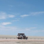
The Roof of Namibia Experience links the Kunene River at Ruacana Falls with the Okavango River along the Angolan border. The route leads through numerous pans and flooded channels known as Shoshana's that move southward from Angola towards the Etosha salt pan. Travelers will enjoy the feeling of a rural landscape interspersed with a bustling urban landscape.
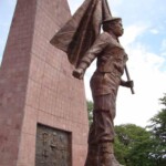
The King Nehale Experience takes travellers along a journey through the colourful towns of Oshakati, Ongwediva and Ondangwa and the starkly contrasting rural villages that surround it. Travellers will have the opportunity to visit the Omugulugwombashe National Monument, Uukwaluudhi Royal Homestead, Uukwambi Kings Monument, Oshakati Open Market, Ongula Traditional Homestead, Nakambale Museum and Lake Oponono and experience the abundant wildlife of the Etosha National Park.

