Mamili was officially proclaimed on 1 March 1990, just days before Namibia gained Independence. The name of the park refers to the seven chiefs of that name who, since 1864, have ruled over the Mafwe people living in this eastern section of the Caprivi Region. Some refer to the area as Nkasa Lupala Park, in reference to the two dominant islands in the park.
This is the largest wetland area with conservation status in Namibia, and is a haven for wetland species. When the flood waters from the Kwando River are high, Mamili becomes like a mini Okavango Delta. There are close to 1 000 buffalo in Mamili, the largest concentration in the country. It is also an important corridor for elephants moving from Botswana to Angola and Zambia and is considered a core breeding area for wildlife that can disperse into neighbouring conservancies.
Proclamation: Mamili National Park in 1990
Park size 320 km2
Natural features: Most of the park consists of channels of reed beds, lagoons and termitaria islands. The Kwando River forms the western boundary and the Linyanti River the south-eastern border.
Vegetation: Tree and Shrub Savannah Biome.
Vegetation types: Caprivi Floodplain. Reeds, sedges, and papyrus, wild date palms (Phoenix reclinata). Tall trees such as jackal-berry (Diospyros mespiliformis) and mangosteen (Garcinia livingstonei) along the water edges and on the termitaria.
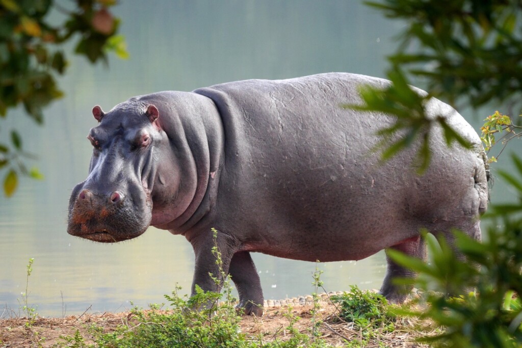
Wildlife: Hippo, crocodile, elephant, buffalo, lion, leopard, hyaena, African wild dog, roan antelope, common impala, red lechwe, reedbuck, sitatunga, kudu, warthog, spotted-necked otter, rock and water monitor lizard. The 430 species of birds recorded, include breeding pairs of rare Wattled Cranes; Slaty Egret, Stanley’s Bustard, Rosy-throated Longclaw, Dickinson’s Kestrel, Allen’s Gallinule, Lesser Jacana, Black-winged and Red-winged Pratincoles, Long-toed Lapwing, Luapula Cisticola, Coppery-tailed Coucal and Black Coucal.
Tourism: Mamili provides the ultimate wilderness experience. A 4×4 vehicle equipped with recovery equipment is required. No facilities, so visitors must be self-sufficient. Park fees must be either pre-paid at MET offices in Katima Mulilo or Windhoek or upon arrival. Two designated camping areas – Mparamura (known also as Nzalu), and Lyadura on the banks of the Kwando River. A recently constructed bridge has improved access to this park.
Key management issues: MET staff carry out game monitoring, game counting and anti-poaching patrols within the park. These are hampered by the terrain – during years of flooding, up to 80 per cent of the park is inaccessible by vehicle. Research is needed to ascertain why numbers of red lechwe have dropped. Possibilities include attacks by baboons or predators.
Disturbance of floodplain and grassland species by human activities, particularly those that breed here and disturbance of species using the islands as refuges during flood periods are red flags in management plans. Poaching sometimes occurs, although cooperation with neighbouring conservancies, conservancy game guards and local NGOs helps reduce illegal activities.
Future plans: In accordance with the Strategic Management Plan for Namibia’s North-East Parks, Mamili is categorised as a Very Important habitat zone. Tourism activities and developments need to be carefully assessed and planned to retain the natural balance of this wetland eco-region.
A tourism concession will be developed in the park in partnership with neighbouring conservancies in order to boost local support for the park and assist local livelihoods.
A proposal has been put forward for a new, second MET office near Malengalenga that will allow personnel to monitor the east of the park more easily.